Confessing My Worst DM Secrets Part II
World Geography
2025-08-05
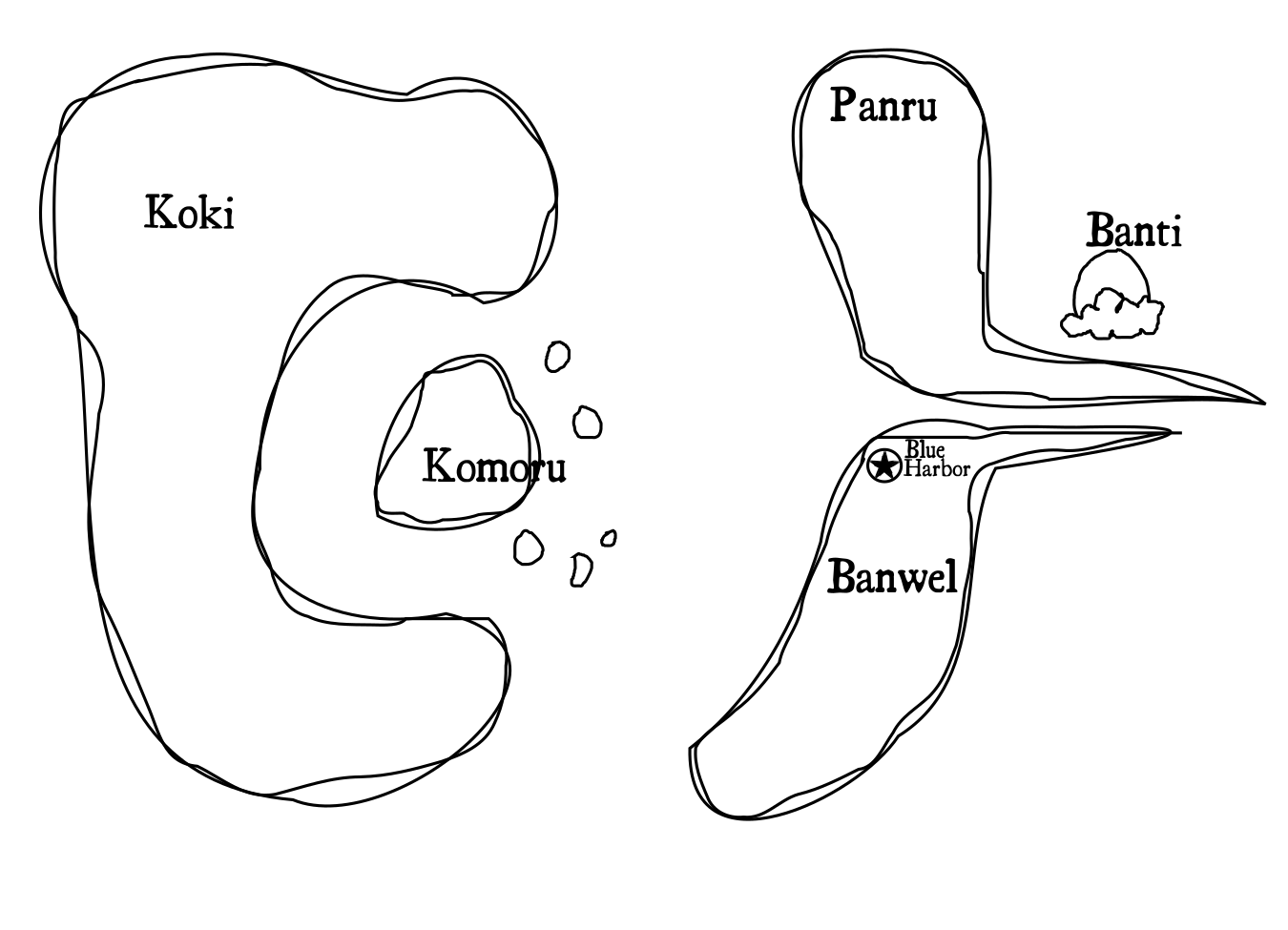
When I sat down to create the world map for my new D&D campaign, I drew on all of the skills and experiences I gained in Kindergarten fingerpainting class, and sketched two rudimentary shapes on a piece of paper. First, a long banana shape, which became the eastern continent Banan. Second, a blob of a cookie shape, which became the western island-continent Koki.
Then, for variety, I split Banan into two continents, “Upper Banana” and “Lower Banana.” To name them, I shuffled the letters around, crossed some out, and shifted some sounds to similar ones1. Upper Banana became Panru, and Lower Banana became Banwel. Finally, Banti (“Banana Tip”) became a floating island city off the coast of Banwel.
Koki gained a huge gulf—as though somebody took a bite—and a large island and archipelago called Komoru (from “Cookie Morsel”).
And that’s the story of how the world of Banankoki came to be.
Please don’t tell my players.
